Succesful Traffic Cases and Studies
PUBLIC AGENCY PROJECTS
City of Maricopa
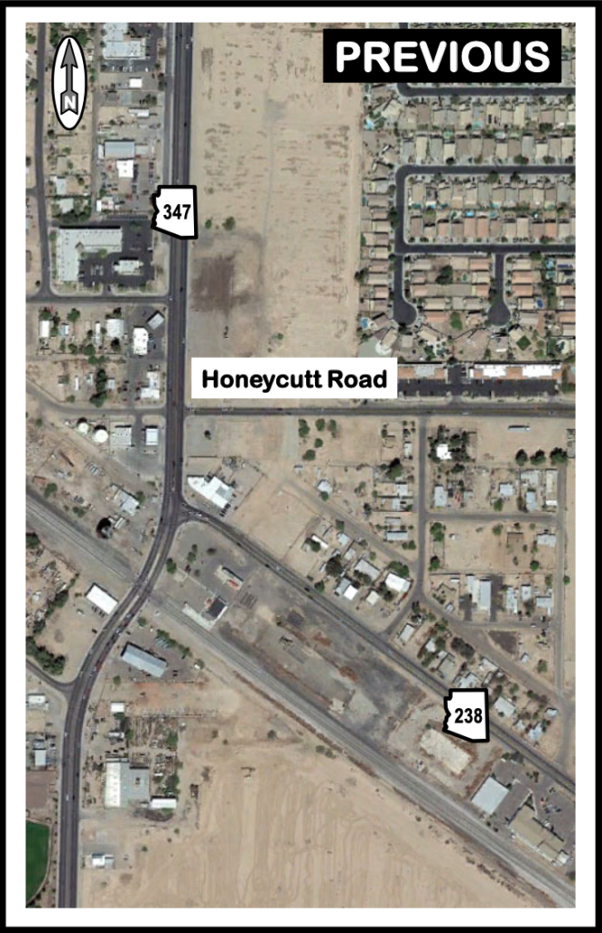
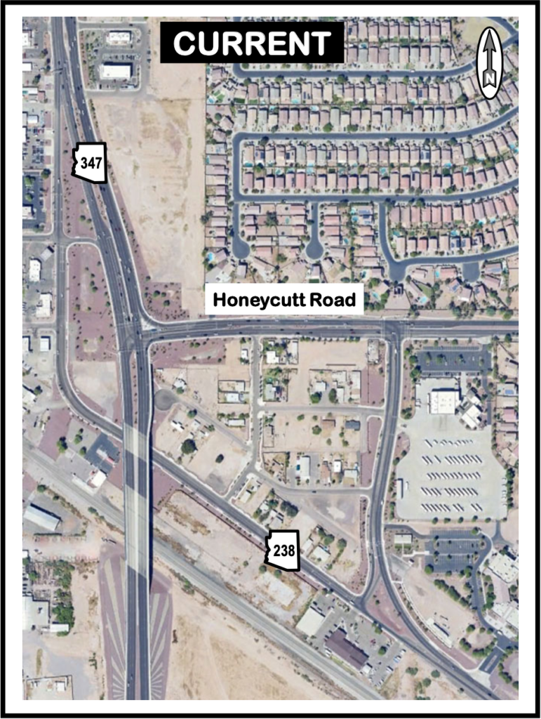
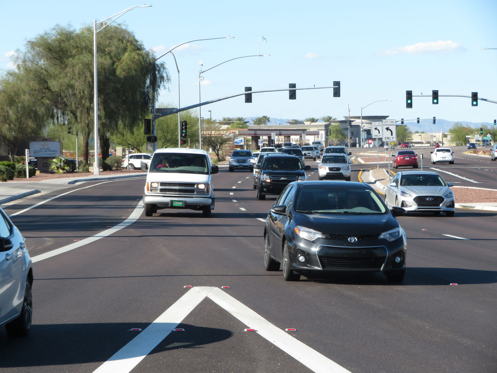
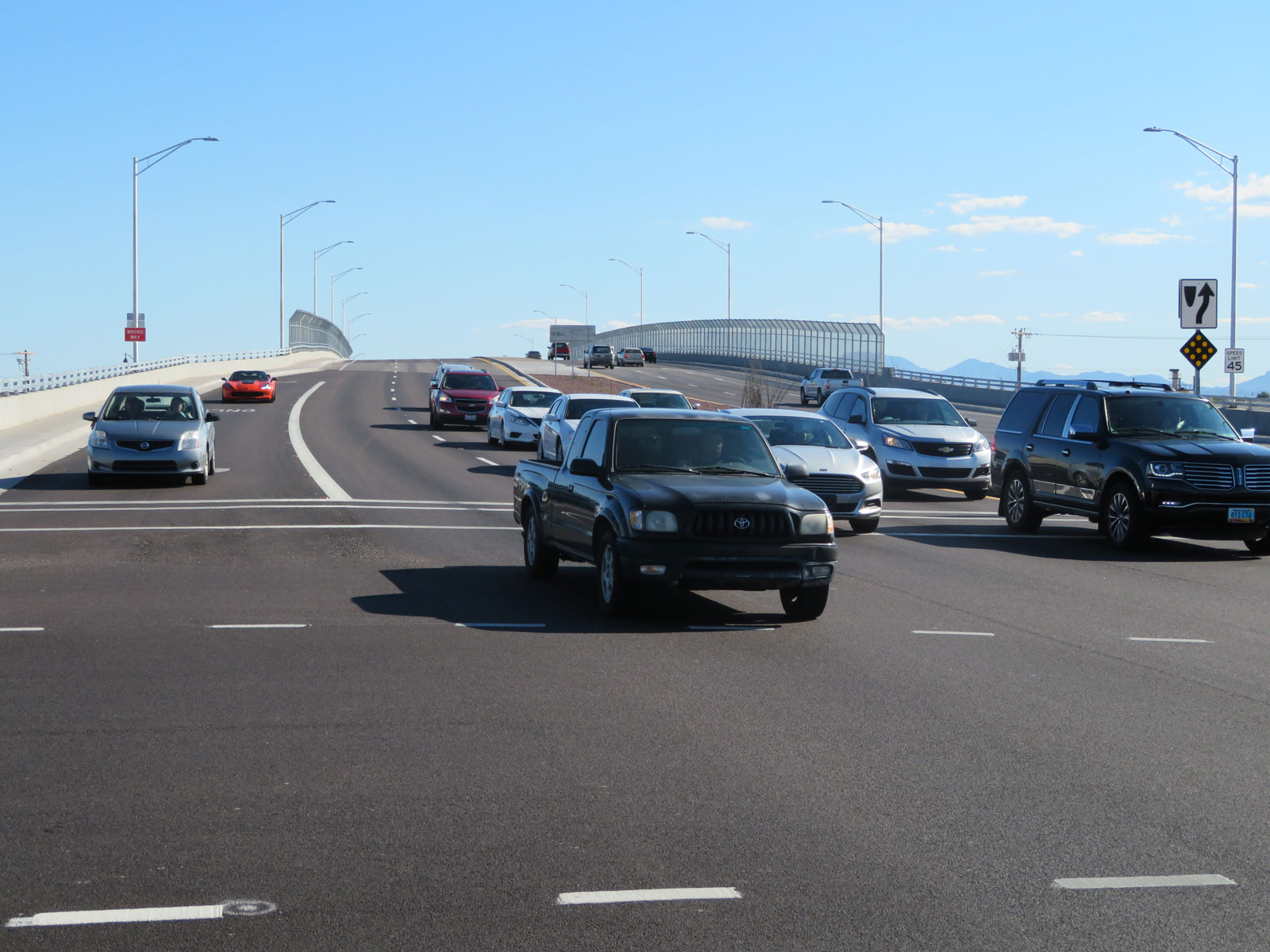
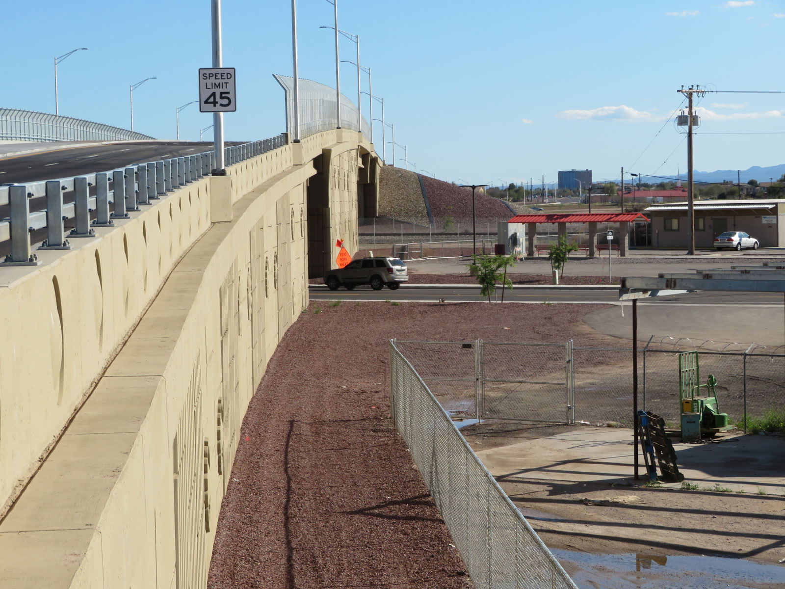
As consultant to the City of Maricopa, Paul developed a unique solution to the complexity of a large-volume high-conflict arterial-arterial intersection in very close proximity to the then-planned SR-347 railroad overpass.
Three other traffic engineering consultants unsuccessfully attempted to solve the difficulty of large volumes of conflicting turning movements at the planned intersection of two state highways – the only through routes in Maricopa – immediately adjacent to the railroad overpass. One of the solutions developed by others was a freeway interchange in downtown Maricopa!
Paul’s solution removed the turning movements from the elevated intersection. The dominant southbound to southeast-bound left-turn volume became a right-turn onto a roadway beneath SR-347, utilizing an extension of the railroad bridge. Paul’s solution also included a separate roadway for the next most dominant northwest-bound to northbound right-turn, and relocated and simplified the northwest-bound to southbound left-turn by eliminating the opposing through traffic.


Tempe
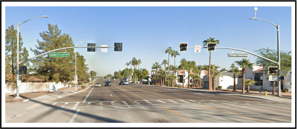
As consultant to the City of Tempe, Paul recommended the first Pedestrian Hybrid Beacons in metropolitan Phoenix at the Western Canal multi-use path intersections with Rural Road and McClintock Drive. Thirteen different possible treatments were evaluated based on fifteen separate criteria. Tempe and many other Valley jurisdictions have since implemented dozens of these Pedestrian Hybrid Beacons.
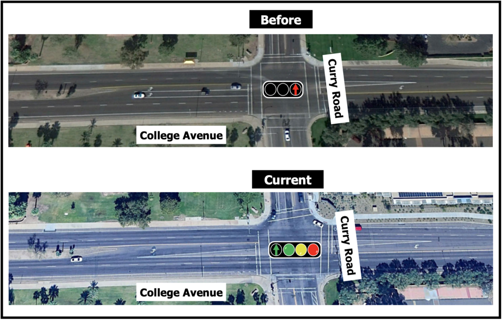
The City of Tempe also asked Paul to analyze left-turn operations at the then congested and inefficient intersection of College Avenue and Curry Road. Paul’s counter-intuitive recommendation was to convert from the dual left-turn lane with red left-turn arrows to a single left-turn lane without red left-turn arrows. Tempe was initially hesitant to reduce from two left-turn lanes to one, but Paul’s detailed analysis was convincing. The conversion has proven highly successful, reducing both left-turn and through traffic delay.
Mesa
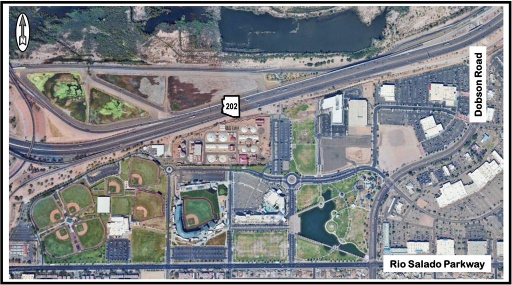
When the Chicago Cubs Spring Training Facility was being planned. Paul Basha was hired by the City of Mesa as the consulting traffic engineer to prepare the Traffic Impact Analyses for the then-proposed facility. The initial plan only had access to Rio Salado Parkway. Paul’s strong recommendation for access to the Dobson Road interchange with SR-202 was constructed with the initial stadium.
Phoenix
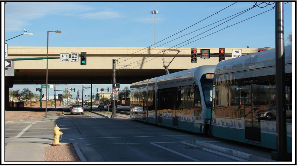
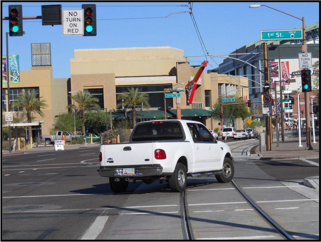
When the light rail began operation, Phoenix was concerned with two collisions per month between personal vehicles and light rail trains. They contracted specifically with Paul Basha to prevent these collisions. After implementing his 7 system-wide recommendations and his 23 specific location recommendations, collisions reduced by 79% at four downtown intersections, all right-turn collisions reduced by 80%, and all left-turn collisions reduced by 24%.
Scottsdale
While serving as Traffic Engineer for the City of Scottsdale, Paul implemented lagging left-turn arrow operations in 1989. After transitioning to consulting, he evaluated eight years of data comparing collisions in a lagging left-turn arrow city to collisions in a leading left-turn arrow city. Scottsdale with lagging arrows had 40% fewer left-turn collisions and no difference in non-left-turn collisions. A report of this study was published in the Institute of Transportation Engineering Journal.
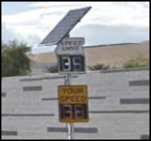
After returning to the City of Scottsdale in 2013 as Transportation Director, Paul implemented the first arterial street variable speed limit signs in the nation, adjacent to a nightclub district in Old Town Scottsdale. The speed limit is 35 miles-per-hour during the week and 25 miles-per-hour on weekend nights through the early morning. This innovation successfully reduced travel speeds during periods of street congestion and high pedestrian activity.
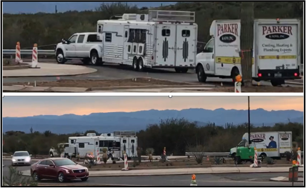
Paul also directed the design of roundabouts on Dynamite Boulevard at 118th Street and 122nd Street to accommodate four-door-pick-up-trucks pulling six-horse trailers, common in this part of Scottsdale.
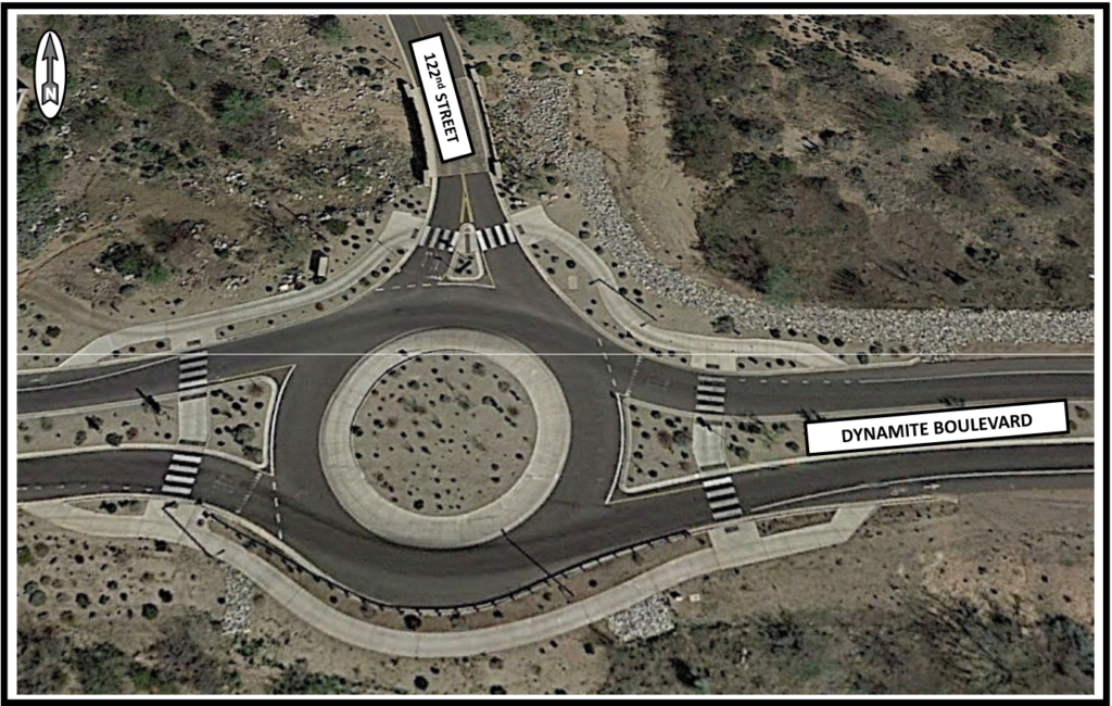
Typically, roundabout center medians are designed for large vehicles to drive onto the rounded curb. Paul wished to ensure safe and comfortable passage for four-door-trucks pulling six-horse trailers. He therefore directed a design that allowed these trucks to travel within the lane rather than bouncing up the curb.
While a consultant, Paul was hired by the City of Scottsdale to conduct a comprehensive analyses of required parking for the primary Scottsdale Preserve trailhead at Gateway Access. His effort resulted in a delicate balance providing sufficient parking for peak trail demand while respecting the natural environment.
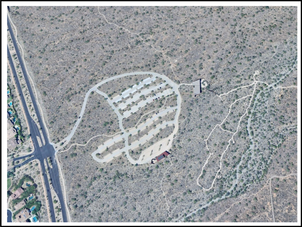
This project required examining the fluctuating historic and current trail use at several Preserve trailheads.
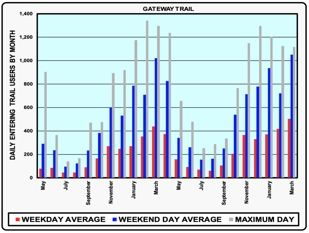
Paul presented this parking analysis topic at an International Transportation Engineers Western District Conference.
PRIVATE CLIENT PROJECTS
Parking Analyses
Paul’s lengthy history of successful parking analyses includes approvals for hotels in several Phoenix metropolitan jurisdictions for significant parking reductions ranging from 40% to 80% of the code requirements.
Summit Land Management utilizes actual hotel parking data, in 30-minute intervals for 48 hours. These comprehensive counts are critical to jurisdiction approval, often revealing considerably lower demand than required by outdated parking ordinances. Summit Land Management also determines shared parking by evaluating the percentage of hotel guests who visit different on-site uses without moving their vehicles.
Summit Land Management has completed more than 50 parking studies for offices, hotels, schools, and recreational projects.
Summit Land Management provides an Executive Summary for each of its Parking Analyses. The Executive Summary is intended to provide jurisdiction decision-makers (Councilmembers and Planning Commissioners) a concise synopsis of the parking analyses. The details of the analyses are provided in the body of the report with elaboration in the appendices. Those parts of the report are directed towards the jurisdiction engineers and planners.
Summit Land Management has developed extensive and efficient quasi-automatic shared parking analyses based on models developed by eight separate agencies. This variety of shared parking models reassures public agencies of the validity of Paul’s analyses and conclusions.
Paul was involved in the preparation of the Institute of Transportation Engineers 5th Edition of the Parking Generation Manual. A recent traffic engineering conference presentation by Paul was entitled, Some Thoughts on Parking Generation, wherein he discussed changing hotel parking needs.
Traffic Impact Analyses
Summit Land Management has prepared more than 250 Traffic Impact Analyses for a wide range of projects including:
A 1,500-acre industrial development
A 500-acre 1,700-home 325,000-square-foot commercial master planned community
A 150-acre 800-home neighborhood
A 7-acre 120-home 27,000-square-foot mixed use development
A 3-acre 23-home subdivision
One of the most critical and controversial aspects of Traffic Impact Analyses is trip generation. Local governments are always very interested in knowing the amount of traffic a proposed development will create. Project opponents often promote exaggerated and false claims regarding trip generation.
Paul was very involved with the Institute of Transportation Engineers preparation and review of the 10th, 11th, and 12th editions of the Trip Generation Manual, and the 3rd and 4th (in preparation for a planned 2027 publication) editions of the Trip Generation Handbook.
He has completed extensive research and analysis of proposed development trip generation, including an article in the ITE Journal, entitled Trip Generation Estimation Methodology., with a companion traffic engineering conference presentation entitled Toward a More Valid Trip Generation Estimation.
Paul is a recognized national expert on proposed development trip generation.
Collision Analyses have become a mandatory part of Traffic Impact Analyses. Summit Land Management has developed a quasi-automated process of identifying and evaluating traffic collisions, which quickly and inexpensively provides the reviewing agency the required information. Reporting collisions can become a source of contention by project opponents. Our analyses and reports provide the reviewing engineers and planners the information they request, while emphasizing the reality that collisions are rare, and avoidable by the drivers.
A proper collision analysis identifies historic collisions and recommends improvements by the jurisdiction that prevent recurrence of similar collisions. Rarely can a private developer implement improvements that prevent repetition of past collisions. However, occasionally, specific roadway modifications necessary for the increased traffic of a development, can simultaneously provide collision mitigation. For example, a right-turn lane, a traffic signal, or a left-turn arrow necessary to accommodate development traffic; may have the added benefit of reducing collisions.
Traffic Access and Circulation Planning
Paul has resolved complicated access and circulation issues for existing and new commercial or residential properties. These studies have ranged from a single gas station on a rural state highway to a 56,000-square-foot commercial development on 12 acres involving three jurisdictions.
Summit Land Management serves as an on-call traffic engineering consultant for charter school organizations, reviewing traffic circulation and operation concerns on existing campuses.
Three Traffic Impact Analyses Project Examples
A project currently in construction in Scottsdale in the northwest corner of Goldwater Boulevard and Indian School Road was delayed for 15+ years because of the 2008 recession and Covid. In the mid 2000’s, the City of Scottsdale required developers to utilize City-selected traffic engineering consultants to prepare their Traffic Impact Analyses, and reimburse the City for the City expense. This then-particular-developer was a regular client of Paul’s, and asked him to also prepare a Traffic Impact Analyses in addition to the City-required consulting traffic engineer. This client clarified that he valued Paul’s opinion and wanted his separate recommendations on their proposed development plan. Paul’s analysis recommended several modifications to their access and circulation that the City-hired-traffic-engineer did not consider. Our client was over- joyed by these suggestions and extensively revised their site plan to implement these revisions.
In the late 2000’s, one of Paul’s clients had a project for an urban mixed use building in Tempe in the northwest corner of Ash Avenue and University Drive. The plan was a ground floor grocery, then second and third floor restaurants, then parking, then a residential tower. At the time, this building type was quite unusual in metropolitan Phoenix, and Mill Avenue was in the throes of substantial uncertainty.
Initially the Tempe City Council was very favorable toward the proposed development. However, as the proposed project progressed, many on the Council had increasing reservations. Nearby residents turned from being supportive of a grocery store to opposing the entire development. The owner of a nearby vacant property, very well- connected to the Council, was contemplating building a typical suburban-style grocery store. One afternoon, three weeks prior to the first public hearings, the rezoning attorney and the client representative met with Paul to inform him that the project would be cancelled.
Paul explained to them that all the reasons for the project remained valid even though many Councilmembers and adjacent residents had changed from supportive to opposing. The surrounding neighborhood had not had a grocery store within a three mile radius for five or more years at that time. In fact, the closest grocery stores to these historic Tempe residential neighborhoods were in Phoenix and Scottsdale. Furthermore, a Tempe grocery store would be closer to residents in these other cities than grocery stores in their cities. Both circumstances were very positive for Tempe sales tax revenue.
Paul’s comments were very persuasive, so the client agreed to pursue the proposed project. Paul prepared simple, very convincing graphics. Also of benefit was that Paul had previously been responsible, as a consultant hired by the City of Tempe, for a recent extensive and successful traffic calming project in a nearby residential neighborhood. The Planning Commission and the City Council approved the mixed-use tower.
Unfortunately, the investors had some internal difficulties that were magnified by the recession. Construction finally began in 2017, and Whole Foods opened in 2019. Both the restaurant and retail components were removed. One of the innovative-to-Phoenix components is that an escalator directly connects from the parking floors to the inside of the grocery store.
Another example of Paul’s past clients many years ago was a day care center and pre- school within a residential neighborhood in Chandler. Paul prepared the Traffic Impact Analysis, and then appeared at the City Council meeting. When Paul walked into the Council meeting room prior to the beginning of the hearing, the rezoning attorney told Paul that there were not four affirmative Council votes. The difficulty was neighborhood opposition to traffic impacts. Fortunately, Paul’s client was moving from a small nearby building to a new larger building, and many of the parents of the children who were students at the existing facility were at the Council to speak in support of the school relocation.
After politely suggesting to the rezoning attorney that Paul should have known of this problem sooner, Paul then explained the necessary strategy. Paul advised the rezoning attorney how to introduce him, mentioning his experience with school traffic. Paul also recommended that the attorney mention the number of years that Paul and this rezoning attorney had resolved similar traffic issues when Paul was a public agency traffic engineer and he was the rezoning attorney representing other private developments.
Paul then explained to the rezoning attorney that Paul needed to present the traffic topic as part of the rezoning attorney presentation, before the opposing neighborhood speakers addressed the Council. Typically, the traffic engineer only responds to questions after the initial presentation and after the neighborhood speakers. Paul clarified to this rezoning attorney that the Council and the opposing neighbors needed to hear Paul explain first that there would be no traffic difficulties, before the Council heard the negative comments. Paul also suggested that the supportive parents should speak last after the opposing residents spoke.
All went exceptionally well. The rezoning attorney’s presentation was brief, Paul’s traffic presentation was extensive with easy-to-understand graphics, detailing the new school access and circulation. When the opposition residents spoke, they were defensive, only complaining anecdotally; in stark contrast to Paul’s very factual and definitive presentation. Finally, the parents of the school children spoke about the advantages of the school, and its importance to their families and to the City of Chandler. The City Council unanimously approved the re-located pre-school and day-care.